Ontario By Bike- Back Packing Blog
- Posted on
- By Bike Ontario
- Posted in Bikepacking, Cycling, Ontario By Bike
- 0
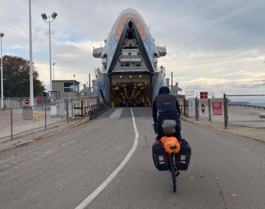
We would like to share Ontario By Bike's latest blog- A highlight of some of the great bikepacking routes available in Ontario. Find our photo from our bikepacking trip last fall. Have any questions about bikepacking in Ontario? Reach out to us, we love talking about bikepacking.

Over the last few years, bikepacking has become increasingly popular. It allows for some epic cycle touring and while it can take many forms, it often gets riders out on a more challenging experience exploring exciting areas off the beaten track. With its diverse landscapes and large network of old railway lines, trails and gravel roads, Ontario is an ideal location for a bikepacking adventure.
If you are unfamiliar with the term, you might ask yourself, what exactly is bikepacking? Essentially it can be described as a mixture of bike touring and backpacking. The routes usually make use of a variety of terrain, often on trails, gravel and dirt roads with limited access to amenities. As a result, on many routes riders need to be self-supported, carrying all their own gear, and camping is usually the main form of overnight accommodation. Generally, bikepacking routes are best tackled on a bike with wider tires and more suspension.
There are a number of routes available in Ontario that will take you out deep into the forested countryside and fuel your sense of adventure while letting you pedal at your own pace. For inspiration, here are six different routes to explore, established by the avid Ontario bikepacking community. Don’t let the length intimidate you, as with some planning all of these routes can be broken down into shorter rides or day trips, roofed accommodations can be used where available, and should you be lucky enough to have a willing driver to carry your gear, or take turns, anything is possible.

Grand Nith Ramble/GNR: Hamilton-Brantford-Waterloo
- Total Distance – 350km
- Elevation Gain – 3,500m
- Paved/Unpaved – 20%/80%
Ride Experience: To me, the Grand Nith Ramble bikepacking route is a glaring example of how you can have a rewarding multi-day cycling adventure without getting too far ‘out-there.’ From riverside trails to rusty old bridges to dirt paths passing through verdant woodlots, this is a route that is fit for an adventurous soul. – Matthew Kadey
While frequently used as an extension of the Butter Tart 700 route, riders should not be fooled as the Grand Nith Ramble easily makes for its own fantastic bikepacking adventure following two of southern Ontario’s most iconic rivers – the Grand and the Nith.
Explore rural trails and some urban ones too, as the Grand Nith Ramble offers plenty of opportunities to get riders immersed in nature while making sure the next pit stop is never too far. Those who are keen to tackle the full 350km tour will be rewarded with a multitude of various terrains and a diverse mixture of trails and gravel roads winding their way along the two rivers.
As the route often sticks close to the riverbeds there are plenty of scenic vistas and a handful of charming old steel truss bridges that allow for great stops to snap pictures. Some of the highlights on this ride include beautiful stretches through the pastoral farmlands of Waterloo Region and a ride through the thick forests of the Dundas Valley, spotting the picturesque waterfalls of the Niagara Escarpment. Passing through the larger communities of Hamilton and Waterloo, there are lots of overnight options that don’t include camping. A suggested ride start location is from the town of St. Jacobs, but the ride can easily be tackled in full or part from anywhere along the route. Detailed Route Info

Butter Tart 700/BT700: Waterloo – Port Elgin - Georgian Bay
- Total Distance – 760km
- Elevation Gain – 5,800m
- Paved/Unpaved – 15%/85%
With an impressive length of over 700km, spanning all the way from the town of St. Jacobs to Lake Huron to Georgian Bay, the Butter Tart 700 marks the pinnacle for many riders looking for the ultimate Ontario bikepacking experience.
Once a year, riders from all over Ontario and beyond flock into the town of St. Jacobs to participate in the grand departure of the BT700. While many riders use this particular weekend to tackle the route, it is truly a self-guided ride that can be completed any time of the year. At an impressive length of 760km, the BT700 gets you out on a demanding but rewarding adventure that will definitely make for some great memories. Plotted along mainly quiet gravel roads and rail trails, the route winds its way northwards all the way to the shores of Lake Huron and back south through central Ontario. Beautiful vistas on top of escarpment county, lakeside views, hilly up and downhill sections, rugged forest trails and small communities with their typical Ontario charm are just a few of the highlights awaiting those who are keen to head out on this loop. Due to the rough terrain, a mountain bike is highly recommended. There are plenty of camping spots and other accommodation options as well as refuelling suggestions that can be all found online to assist with planning. Detailed Route Info

Central Ontario Loop Trail/COLT: Cobourg – Lindsay – Bancroft
- Total Distance – 450km
- Elevation Gain – 2,984m
- Paved/Unpaved – 20%/80%
Ride Experience: This past summer I got to ride a 450km bikepacking trip on the COLT loop with 8 of my best friends and support from our parents. We had such a fun time with a lot of laughs and good music. The route was a blast, just the perfect amount of elevation and views. It took us 7 days with one rest day when the weather was stormy. Overall, the COLT loop was such a great experience and I would highly suggest it to other cyclists looking for a fun, challenging and beautiful bikepacking route around southern Ontario. – Hannah Fennell (17 years old)
The COLT, short for Central Ontario Loop Trail, is the go-to bikepacking adventure for those who are looking to combine a number of trails through central Ontario into a longer route. While seemingly far from anywhere, there are plenty of opportunities to explore unique landscapes and natural sites without ever being too far off the grid.
Following an intertwined network of rail trails, all maintained to different standards, this multi-day tour connects the Victoria Rail Trail, Ganaraska Trail, Hastings Heritage Trail and IB & O Rail Trail, with segments using secondary side roads. The result is an impressive 450km loop taking you out through the countryside of Kawarthas Northumberland, Haliburton Highlands and Hastings County including a beautiful stretch along the Great Lakes Waterfront Trail between Trenton and Port Hope. For those who are new to bikepacking and would like to get their feet wet, the COLT is a great route to begin with, as riders won’t have to compromise on safety or proximity to local amenities. Route Info

Haliburton Highlands: Gooderham – Haliburton – Ragged Falls
Known for its rolling hills, highland views, plus endless lakes and rivers, routes in Haliburton Highlands blend together all the ingredients for a unique bikepacking tour.
For an 85km loop follow some of the best gravel roads in the area and a portion of the Haliburton County Rail Trail on the Southern Haliburton Ramble. Baked goods and refreshments stops can be enjoyed in tiny hamlets of Gooderham, Irondale and Donald.
Use either the town of Haliburton as your base with a 20km road ride to the more rugged gravel roads and trails connecting to Haliburton Forest or start and end your next ride there as camping and other adventure amenities are readily available. A one-way ride from Haliburton to Ragged Falls comes in at 95km. Other shorter loops in the Forest range from 20km to 50km along either gravel roads or side trails with stretches through Canadian Shield rocky outcrops and lush hardwood forests passing a scattering of pristine and pretty lakes. For Haliburton Forest access, be sure to pick up your trail permit and book a campsite at the main office on Redkenn Road.
Find the series of Haliburton Highlands gravel and adventure routes online. Route Info

Sharb Echo Scramble: Sharbot Lake – Bon Echo - Ottawa Valley – Lanark
- Total Distance – 296km
- Elevation Gain – 2,311m
- Paved/Unpaved – 6%/94%
Ride Experience: On paper, the Sharb Echo Scramble might look like a short bikepacking route. That is, until you realize many riders would be in the woods for three days before their first resupply. While this route relies on two different rail trails for part of it, as the route moves further north and west, riders will be challenged with some steep climbs on logging roads and chunky, sometimes flooded ATV trails. The route has its rewards though: It has a number of great trailside swimming spots and berry bushes and impressive examples of remote engineering like a hydro dam and an abandoned government air strip. To avoid bugs and wet shoes, August and September are the best times of year to ride the route. – Paul Galipeau
Set in eastern Ontario, the Sharb Echo Scramble is another route through Ontario’s Highlands, that will get riders out into the largely uninhabited countryside and wilderness enjoying the beauty of the Ottawa Valley and Lanark County.
Best tackled over 3 or 4 days, the Sharb Echo Scramble is a true bikepacking adventure that is suited to self-supported riders, carrying all they need. With 94% of the route being unpaved make sure your bike is suitable for a ride on what’s mostly along historic railway trails, ATV paths, hilly hydroline cuts and curvy logging roads. Anchored by and passing near two beautiful provincial parks, Bon Echo and Sharbot Lake, riders can camp and make use of park amenities or set up their own camp along large stretches of untouched crown land.
There are numerous highlights on this 295km loop ranging from scenic water vistas over secluded lakes, the Mountain Chute hydro dam spanning the Madawaska River and even an old abandoned airstrip in the middle of nowhere. While the route can easily be started out from the Trans Canada trailhead in Sharbot Lake, there are a number of other options along the way that might be more suitable. Map and ride details, plus start options, refuelling stations and overnight stops can be found online. Detailed Route Info
Log Driver’s Waltz/LDW: Ottawa Valley – Outaouais Region
- Total Distance – 794km
- Elevation Gain – 7,133m
- Paved/Unpaved – 20%/80%
Ride Experience: If you're looking for a bucket list route that lets you experience some of Ontario and Québec's best rugged backroads, this could be it. Along its 800+ kilometres, you'll find yourself amidst the ruins of old homesteads, rolling over impressive chunks of Canadian Shield, and face to face with active logging operations that represent the industry that has shaped so much of this region. If you're lucky, you'll find yourself camping by a Crown land lake - maybe even with a sandy beach. One nice thing about the LDW as a route is that with a bit of creativity, it exposes an infinite number of short (or longer!) variations. – Paul Galipeau
The Log Driver’s Waltz is a cross-regional bikepacking route through the Ottawa Valley and Outaouais regions that straddle the two provinces of Ontario and Quebec, divided by the Ottawa River. While satisfying the needs of those who are looking for an off-the-beaten-path extended ride adventure, it showcases the quiet beauty and rugged wilderness waterways of the area.
Rich in natural resources, early settlers were drawn to the large forests of Eastern White Pine and nearby rivers that made export easy. Hence, the route is aptly named after a daring dance used to free log jams as the lumber floated downstream on the Mississippi, Madawaska, Ottawa and Gatineau Rivers. As the industry changed, railroads and logging trails were abandoned, leaving behind a network of quiet trails and unmaintained roads, with sweeping riverside views, perfectly suited for bikepacking.
On over 800km, this diverse ride routes through crown land and thick forests, with lots of opportunities to pitch a tent, plus small communities and rural farmlands that are dotted with lonely farmhouses and sugar shacks. Explore Gatineau Park in Quebec, and ride into downtown Ottawa along the city’s fantastic and well-maintained trail network. To tackle this ride, a gravel or mountain bike is most suitable, as the majority of the route is unpaved. Detailed Route Info
The Ultimate Adventure

If one of these routes is not enough for you, why not extend the ride and turn it into the ultimate cycling adventure? Thanks to Ontario’s avid bikepacking community, it is now possible to connect a number of these routes, following a network that spans over 3,000km or more, simply create a route that suits your skill level and time available. More information on what is dubbed the ONXL epic Ontario bikepacking adventure is online. Learn More
Comments
Be the first to comment...